rockhound.fetch_etopo1
-
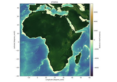
rockhound.fetch_etopo1(version, *, load=True, **kwargs)[source]¶ Fetch the ETOPO1 global relief model.
ETOPO1 is a 1 arc-minute global relief model of Earth’s surface that integrates land topography and ocean bathymetry [AmanteEakins2009]. It’s available in two versions: “Ice Surface” (top of Antarctic and Greenland ice sheets) and “Bedrock” (base of the ice sheets). Each grid is in a separate gzipped netCDF file (grid-line registered version). The grids are loaded into
xarray.Datasetobjects.The vertical datum is sea level and the horizontal reference is the WGS84 ellipsoid.
If the files aren’t already in your data directory, they will be downloaded automatically (which may take a while). Each grid is approximately 380Mb.
- Parameters
version (str) – Which version of the dataset to load. Can be
"ice"for the ice surface version,'bedrock'for the bedrock version.load (bool) – Whether to load the data into an
xarray.Datasetor just return the path to the downloaded data.kwargs – Keyword arguments will be forwarded to the
xarray.open_datasetfunction that loads the grid into memory.
- Returns
grid (
xarray.Datasetor str) – The loaded grid or the file path to the downloaded data.