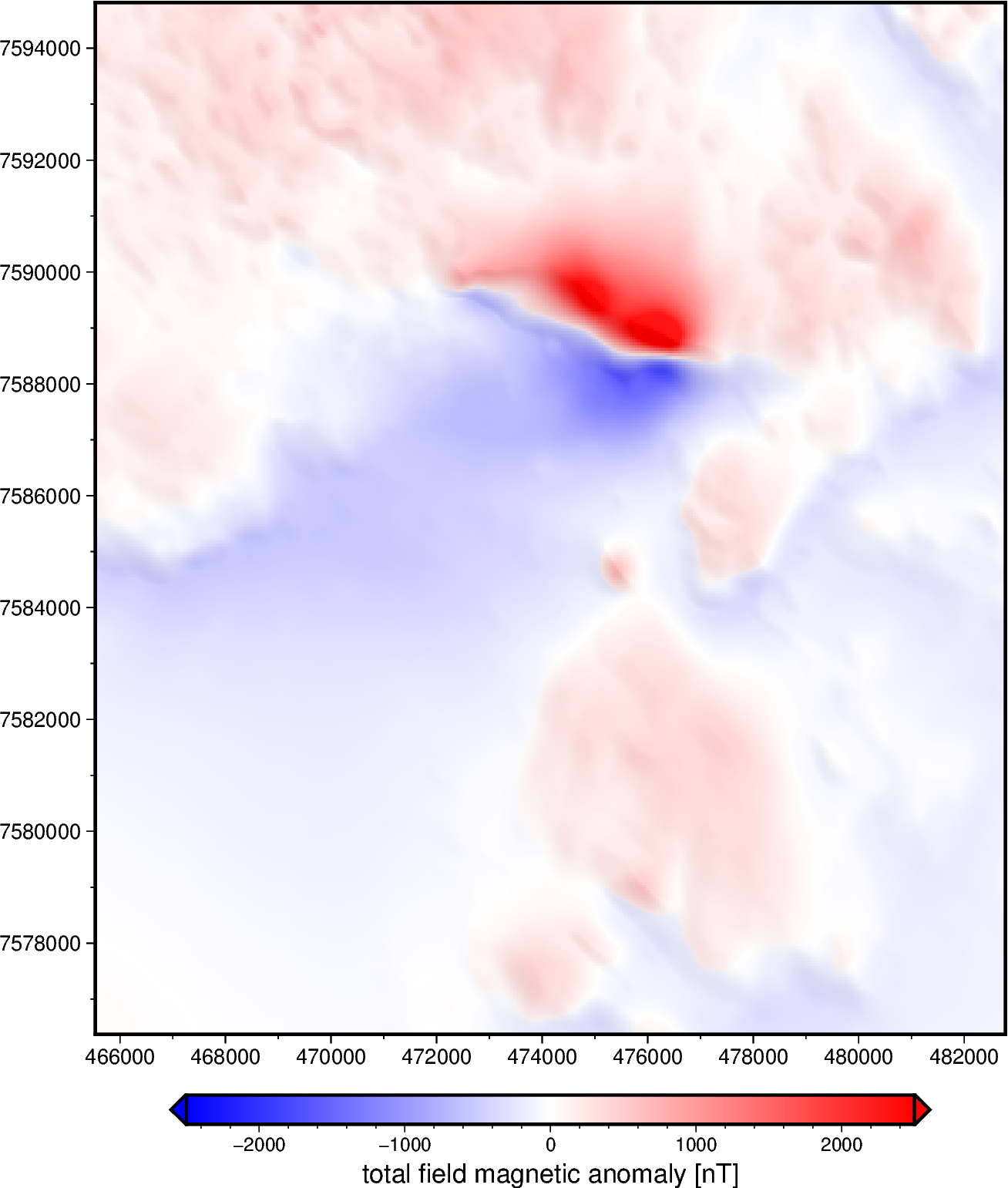
Magnetic anomaly grid of the Lightning Creek Sill Complex, Australia#
This is a section of an airborne survey acquired in 1990 by the Queensland
Government, Australia. The grid has 50 m resolution (UTM coordinates) and
is at a uniform orthometric height of 500 m.
Magnetic total-field anomaly of the Lightning Creek sill complex, Australia
crs :
proj=utm zone=54 south datum=WGS84 units=m no_defs ellps=WGS84 towgs84=0,0,0
source :
Interpolated from airborne magnetic line data using gradient-boosted equivalent sources
license :
Creative Commons Attribution 4.0 International Licence
references :
Geophysical Acquisition & Processing Section 2019. MIM Data from Mt Isa Inlier, QLD (P1029), magnetic line data, AWAGS levelled. Geoscience Australia, Canberra. http://pid.geoscience.gov.au/dataset/ga/142419
long_name :
total-field magnetic anomaly
units :
nT
actual_range :
[-1785. 3798.]
Make a PyGMT pseudo-color map of the total field magnetic anomaly.