Note
Click here to download the full example code
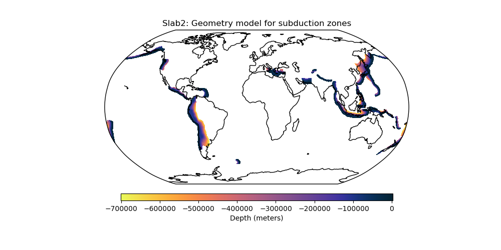
Slab2 - A Comprehensive Subduction Zone Geometry Model
Slab2 is a three-dimensional compilation of global subduction geometries, separated into regional models for each major subduction zone. More information at the USGS website.

Out:
/home/santi/git/rockhound/examples/slab2.py:52: UserWarning: Matplotlib is currently using agg, which is a non-GUI backend, so cannot show the figure.
  plt.show()
import rockhound as rh
import matplotlib.pyplot as plt
import cmocean
import cartopy.crs as ccrs

from rockhound.slab2 import ZONES

# Fetch all Slab2 subduction zones and add them inside a list
subduction_zones = []
for zone in ZONES:
    subduction_zones.append(rh.fetch_slab2(zone))

# Get min and max values of the subducting plates' depths
vmax = max([grid.depth.actual_range[1] for grid in subduction_zones])
vmin = min([grid.depth.actual_range[0] for grid in subduction_zones])

# Plot the depth of each subducting plate inside Slab2 with the same colorscale
plt.figure(figsize=(10, 5))
ax = plt.axes(projection=ccrs.Robinson())
for grid in subduction_zones:
    pc = grid.depth.plot.pcolormesh(
        cmap=cmocean.cm.thermal_r,
        ax=ax,
        transform=ccrs.PlateCarree(),
        add_colorbar=False,
        vmin=vmin,
        vmax=vmax,
    )
ax.set_title("Slab2: Geometry model for subduction zones")
plt.colorbar(
    pc,
    ax=ax,
    label="Depth (meters)",
    pad=0.05,
    aspect=40,
    shrink=0.7,
    orientation="horizontal",
)
ax.set_global()
ax.coastlines()
plt.show()
Total running time of the script: ( 0 minutes 27.209 seconds)