rockhound.fetch_slab2
-
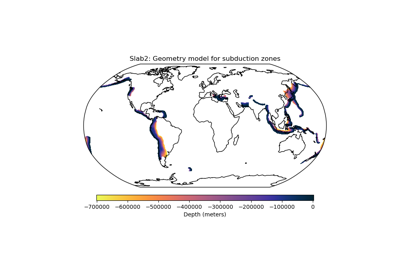
rockhound.fetch_slab2(zone, *, load=True)[source]¶ Load the Slab2 model for a given subduction zone.
Slab2 is a three-dimensional compilation of global subduction geometries (depth, dip, strike and thickness), separated into regional models for each major subduction zone. Each model is based on a probabilistic non-linear fit to data from a combined catalog consisting of several independent data sets - historic earthquake catalogs, CMT solutions, active seismic profiles, global plate boundaries, bathymetry and sediment thickness information [SLAB2].
- Parameters
zone (str) –
Subduction zone to fech the model. Available zones:
alaska: Alaskacalabria: Calabriacaribbean: Caribbeancascadia: Cascadiacentral_america: Central Americacotabalo: Cotabalohalmahera: Halmaherahellenic: Hellenic Archimalaya: Himalayahindu_kush: Hindu Kushizu_bonin: Izu-Boninkamchatka: Kamchatka-Kuril Islands-Japankermadec: Kermadecmakran: Makranmanila_trench: Manila Trenchmuertos_trough: Muertos Troughnew_guinea: New Guineapamir: Pamirphilippines: Philippinespuysegur: Puysegurryukyu: Ryukyuscotia_sea: Scotia Seasolomon_islands: Solomon Islandssouth_america: South Americasulawesi: Sulawesisumatra_java: Sumatra-Javavanuatu: Vanuatu
load (bool) – Whether to load the data into an
xarray.Datasetor just return the path to the downloaded data. If False, will return a list with the paths to the subduction grids, respectively.kwargs – Keyword arguments will be forwarded to the
xarray.open_datasetfunction that loads the grid into memory.
- Returns
grid (
xarray.Datasetor str) – The loaded grid or the file path to the downloaded data.